

One of the unique structural features of Sheepwash are the two tunnels or aqueducts which pass underneath The Birmingham Mainline Canal and railway line in the direction of Lower Tividale. They originally date from around 1838 when the canal was constructed and then extended when the railway followed in 1852. It has also been suggested that further stability works were carried out due to the infamous canal breach of 1899, when several miles of the Birmingham New Mainline emptied due to a breach of the embankment connected to Rattlechain Brickworks.
Depending on if you live on the Denbigh or Newtown estates there may be some confusion as to whether they are known as “the first tunnel” and “the second tunnel”, so for the purposes of this page they will be known as Rose Lane Tunnel and Johns Lane Tunnel.
ROSE LANE
This former road ran in the direction of Tividale and its story can be read HERE. Officially this tunnel is known as “Moores Aqueduct” and is constructed mainly from blue bricks which were made locally at many works, including the two former works which Sheepwash now occupies land on, and see further below for an interesting find.
I have discovered the probable origin of the name Moor or Moore named after the occupiers of the land in the area by this name (Thomas and Jesse), when the canal was constructed. They apparently ran a sand mine and their names are recorded on an old waterways deed map from the period shown below.
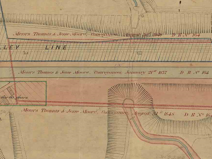
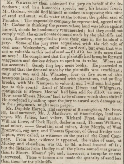
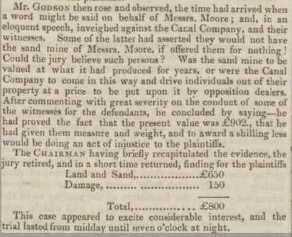
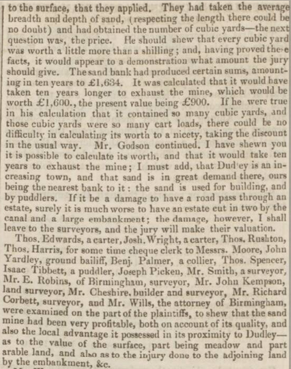
Further information from the British Newspaper Archive reveals a contested legal dispute between the Moores and the canal company regards the land. The January 9th 1836 Staffordshire Advertiser explains the value of the land dispute, before the canal was built.
The canal company had held out on purchasing the land due to the price that the sand merchants had asked for. After both sides calling several witnesses of differing opinion as to the value, a jury decided on a final sum.

A further mention of the individuals is made in the Aris’s Birmingham Gazette of 20th March 1848. This appears to suggest J. H Moore was a solicitor in Walsall if his name was Jesse. The mining estate of considerable size was up for lease.
The canal was obviously built and then railway, and the tunnel used by many generations since.
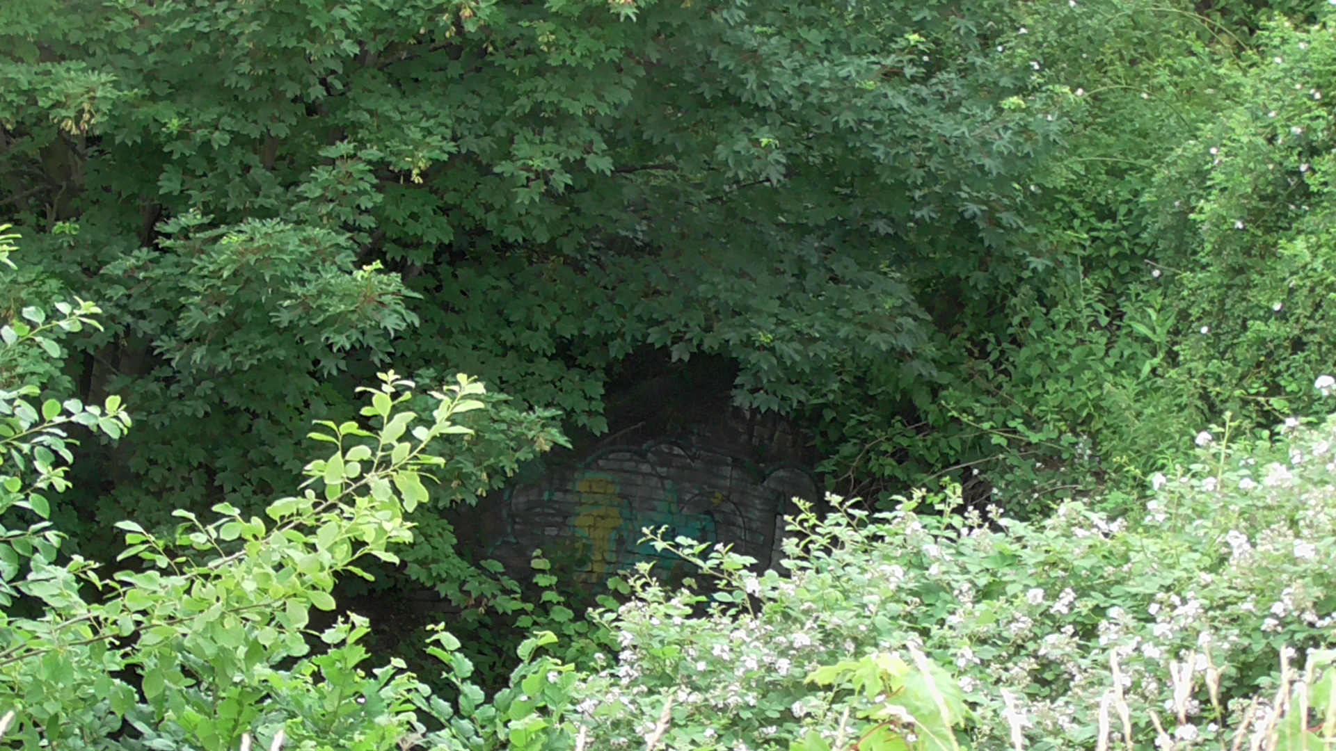
Unfortunately, two rights of way from Rose Lane and the River Tame were substantially blocked through foundry sand dumping works in the later part of the 20th Century and now a poor zig zag path descends from the Canal almost obscuring the tunnel altogether when vegetation is more prominent in Summer.
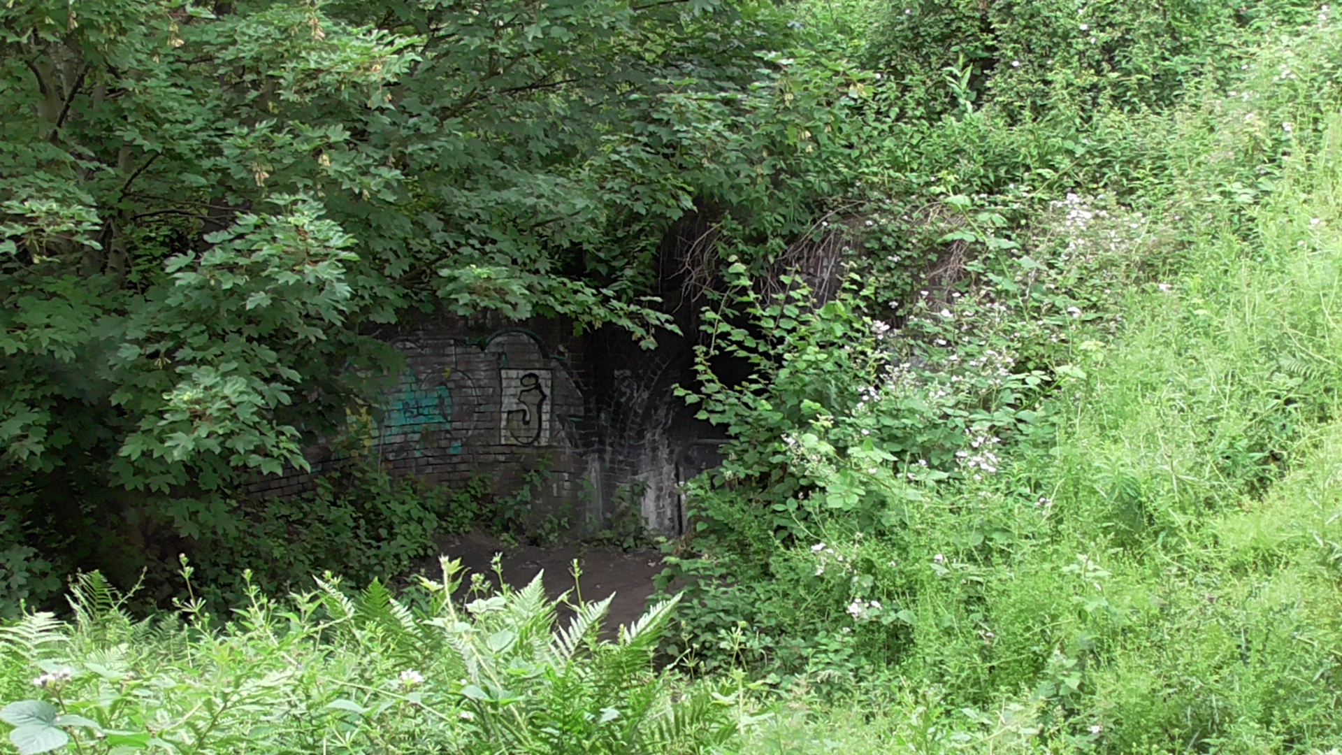
The tunnel entrance from here suffers substantial clogging due to the instability of this sand leaking into the tunnel, and the council have already spent money unblocking it from flooding, only for the issue to continue.
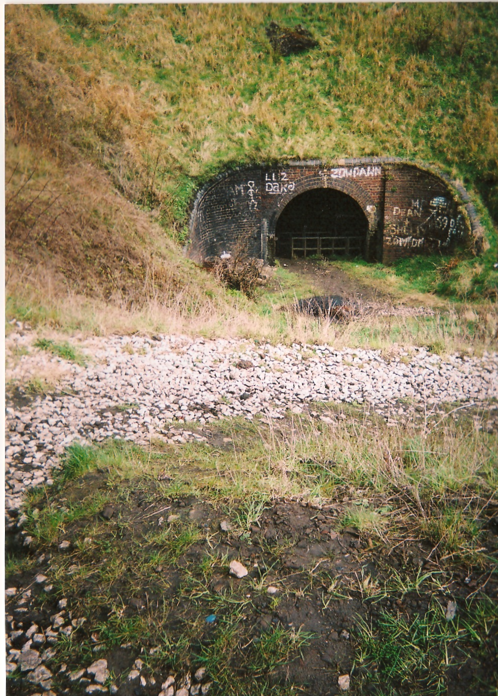
Tunnel entrance looking North towards Sheepwash.
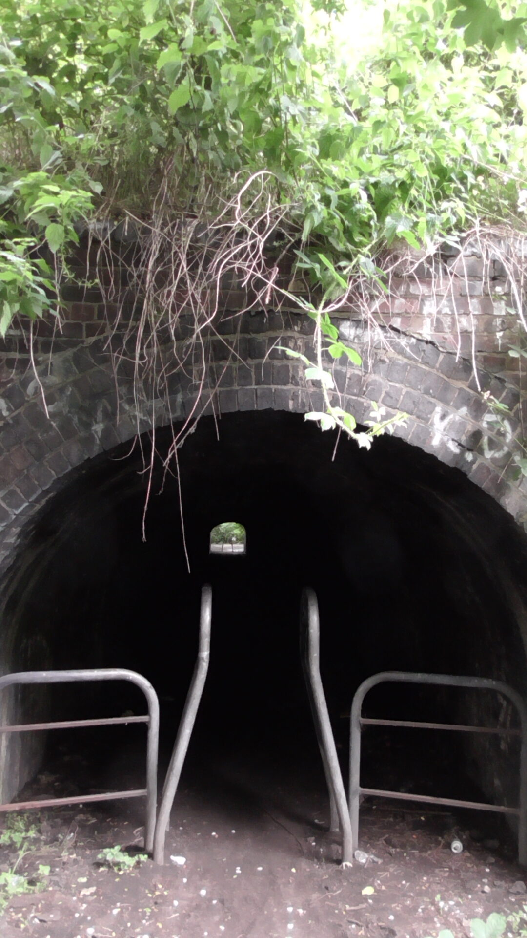
Originally, the barriers at this end were robust enough to stop motorbikes coming from off the abandoned land adjacent to the canal, but someone in their wisdom at the council decided to install the inferior easy access barriers shown above, which now means that bikes are regularly accessing Sheepwash.
Entrance to Sheepwash via canal circa 2006
Despite the clearance of sand, it has now crept back to cover nearly half the floor of the tunnel, and this will continue to be an issue it appears for years to come.
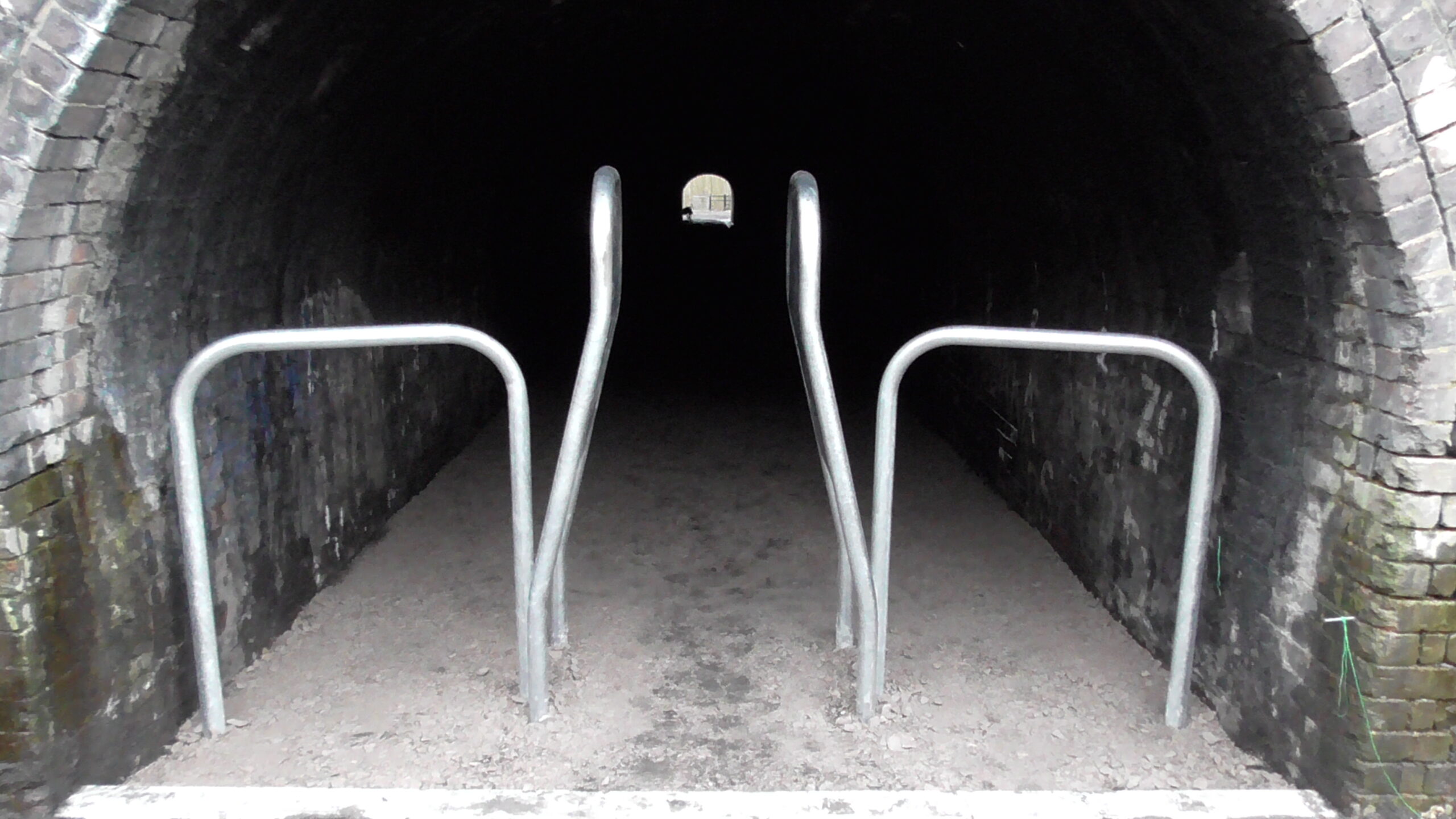
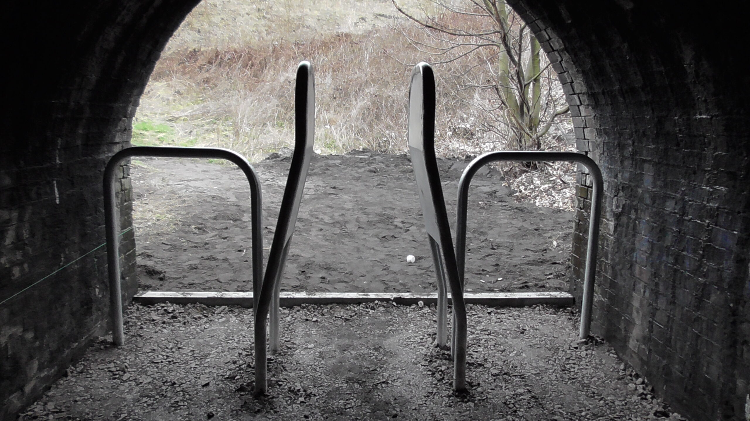
Image taken 2016 showing recently cleared tunnel floor

A line in the sand
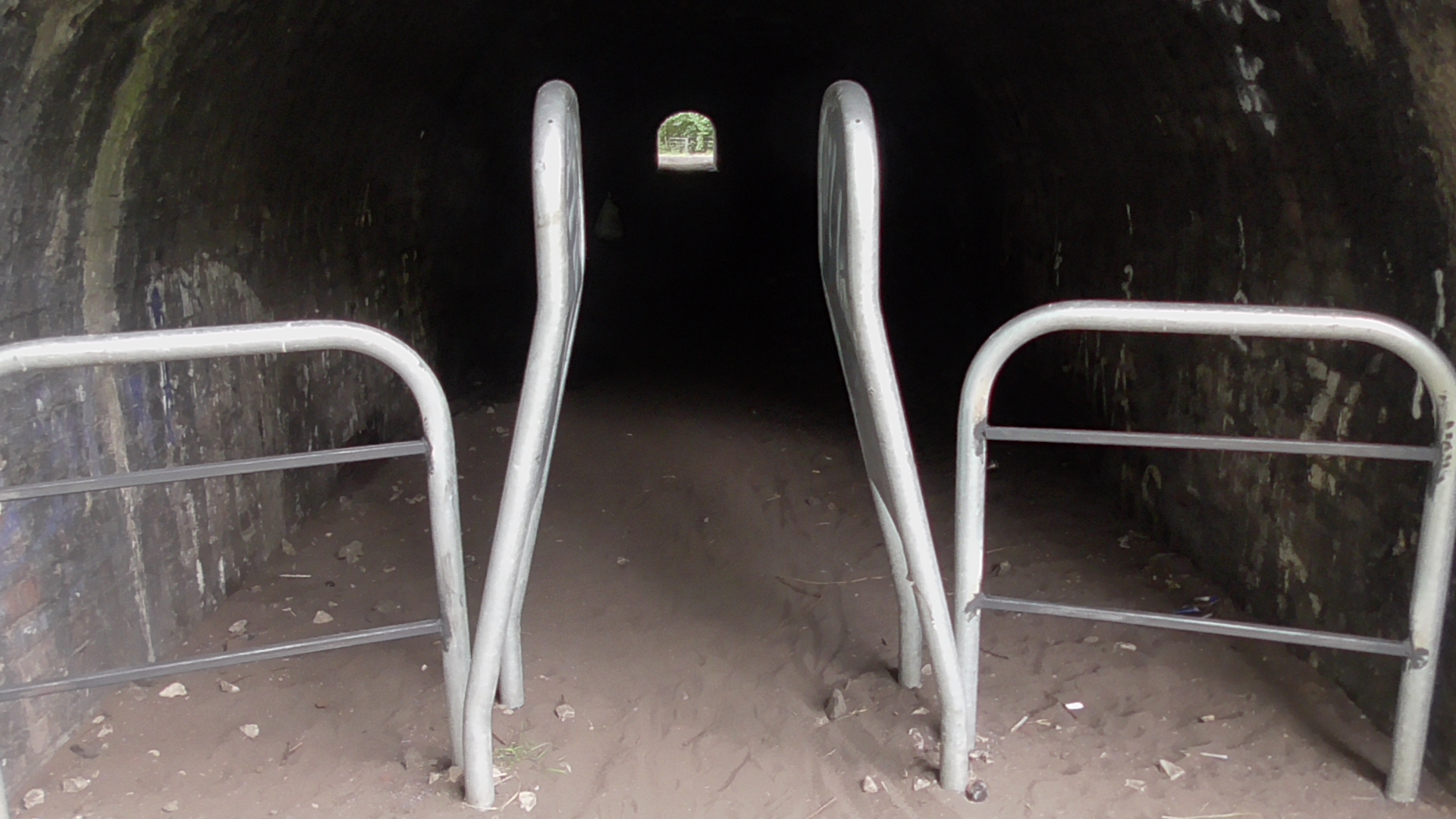
Image taken 2017 showing how foundry sand has crept back into tunnel

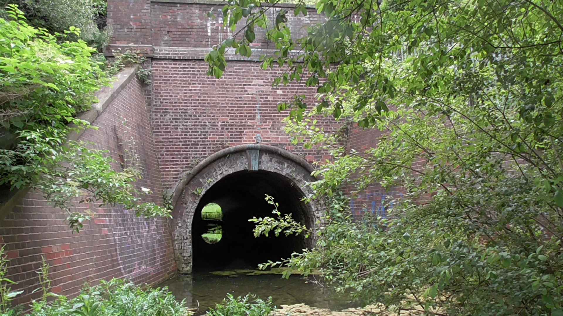
The tunnel shown by measurement markings during upgrade works appears to be around 72 metres in length.

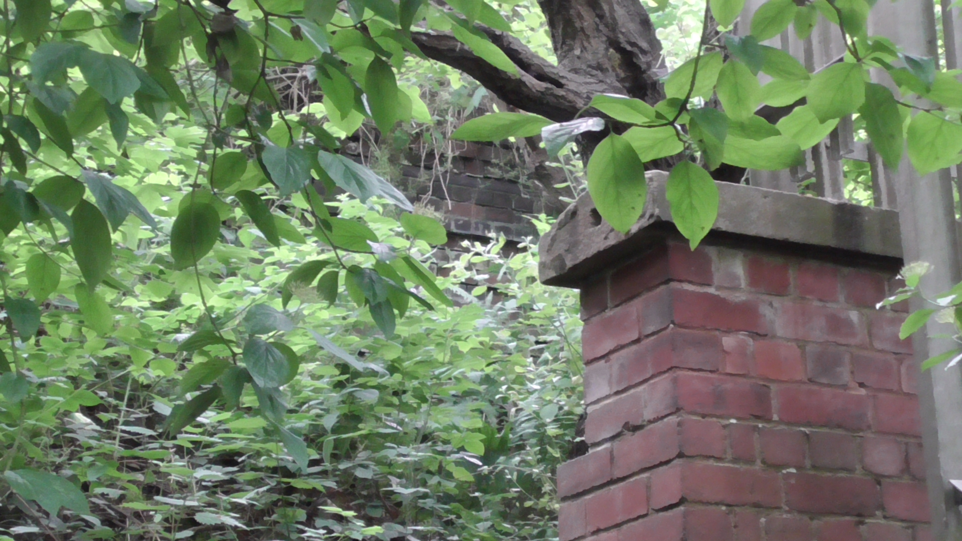
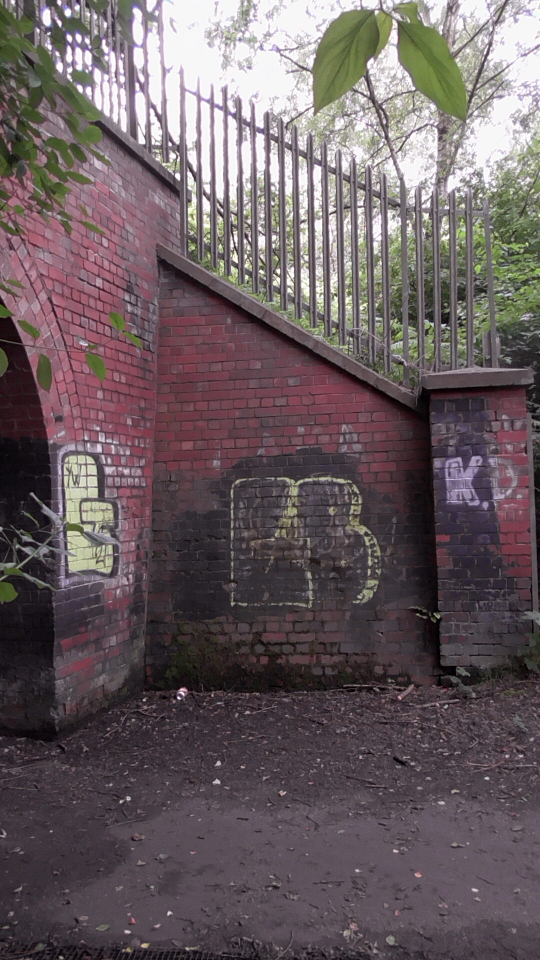
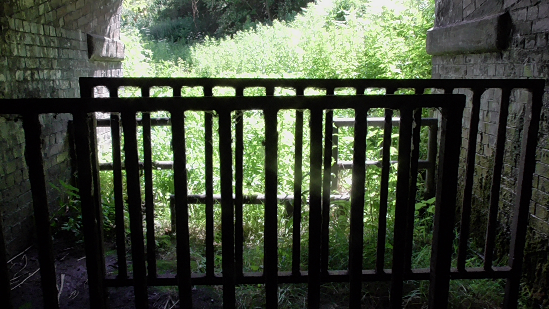
What is also evident is the extra extension part of the tunnel made with red bricks. This extra canopy has an elaborate structure which strengthens the tunnel underneath the railway line and embankment itself. The railings on top of this were added to prevent access to the line in the early 2000’s.

There is however a hole in the fence line, and exploring on top of the tunnel reveals more about the bricks that built it.
Strong bannister type supports at either end
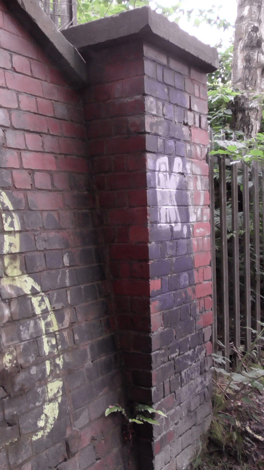
The old end of the tunnel is above the extended embankment and clearly is made from blue bricks.
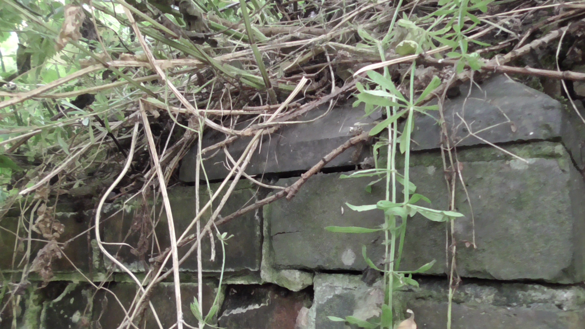
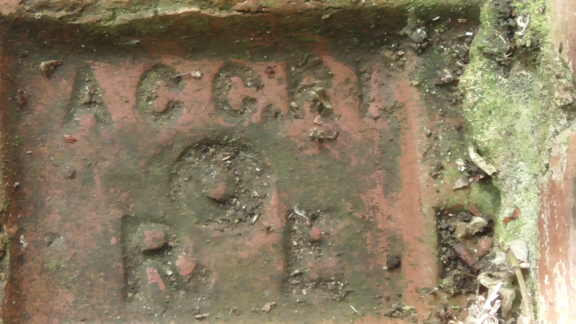
On lifting one of the loose coping stones, it revealed the manufacture.

From research, I know that this “W” together with the Star of David symbol indicate that it was made by Woods of the Pumphouse brickworks. The Wood family were a prolific local brick manufacturer who owned several brickworks in the Tividale area. There are now several streets named after them, including the patriach, George Wood in the Sandwell area.
Tipton Historian Keith Hodgkins sent me the following extract of an advert from the period, and one like that used at the time.

Kelly’s directory 1880
A later publication from 1884 shows that this was a P and S Wood trademark. We can therefore say that this particular brick was added some time after the original tunnel was built, and must have been a replacement or even extension itself.
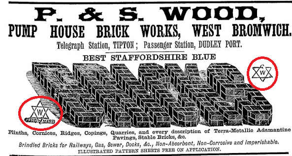
Kelly’s 1884 Worcestershire directory
Johns Lane
Officially this structure is known as Cooper’s Aqueduct. I have yet to find out if this was named after a particular person or the trade of barrel making, but I suspect the former.
This tunnel forms part of The John’s Lane Right of Way, and I have looked at the history of the Oldbury side of this HERE.

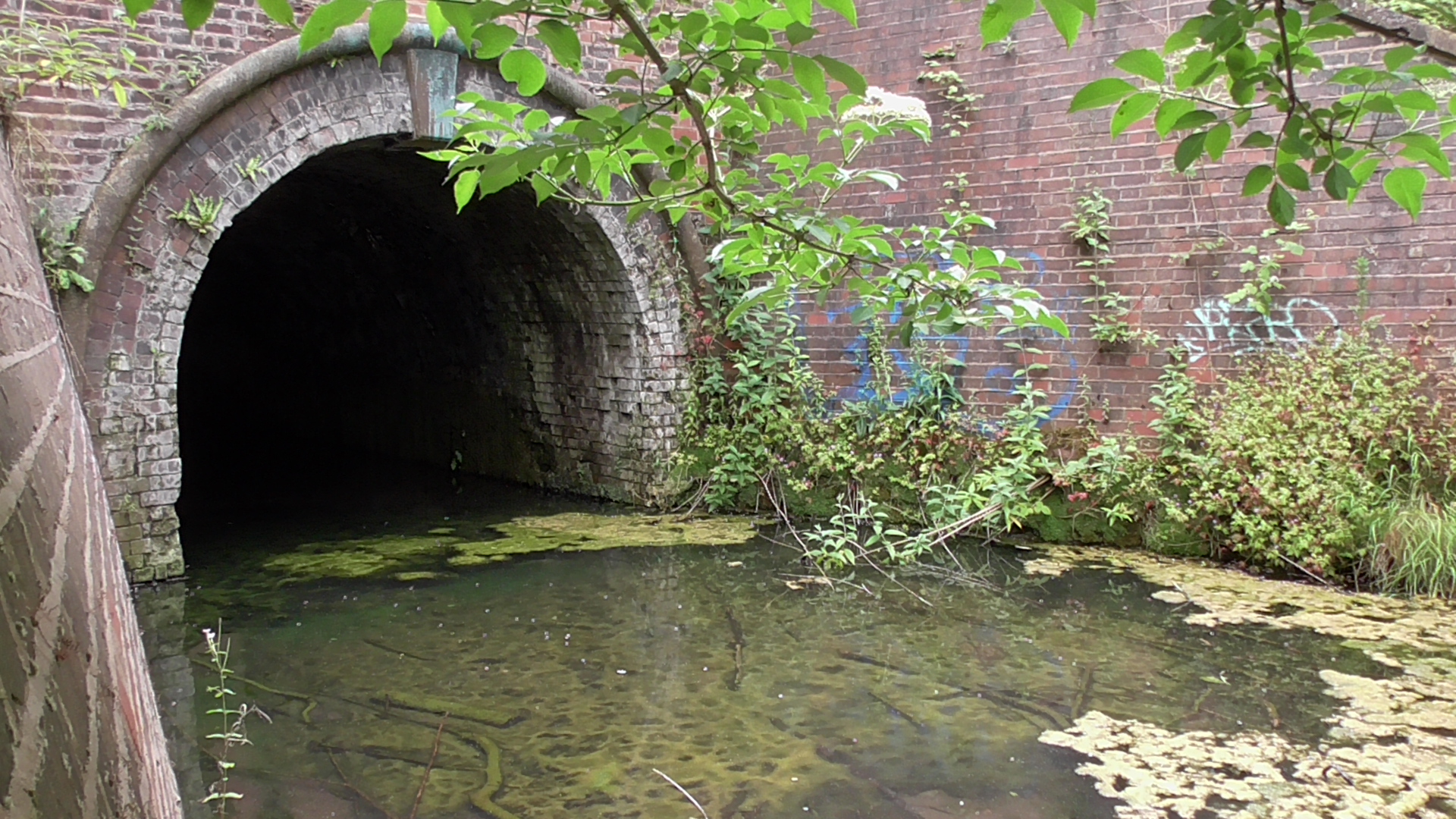
The way to Sheepwash from Tividale
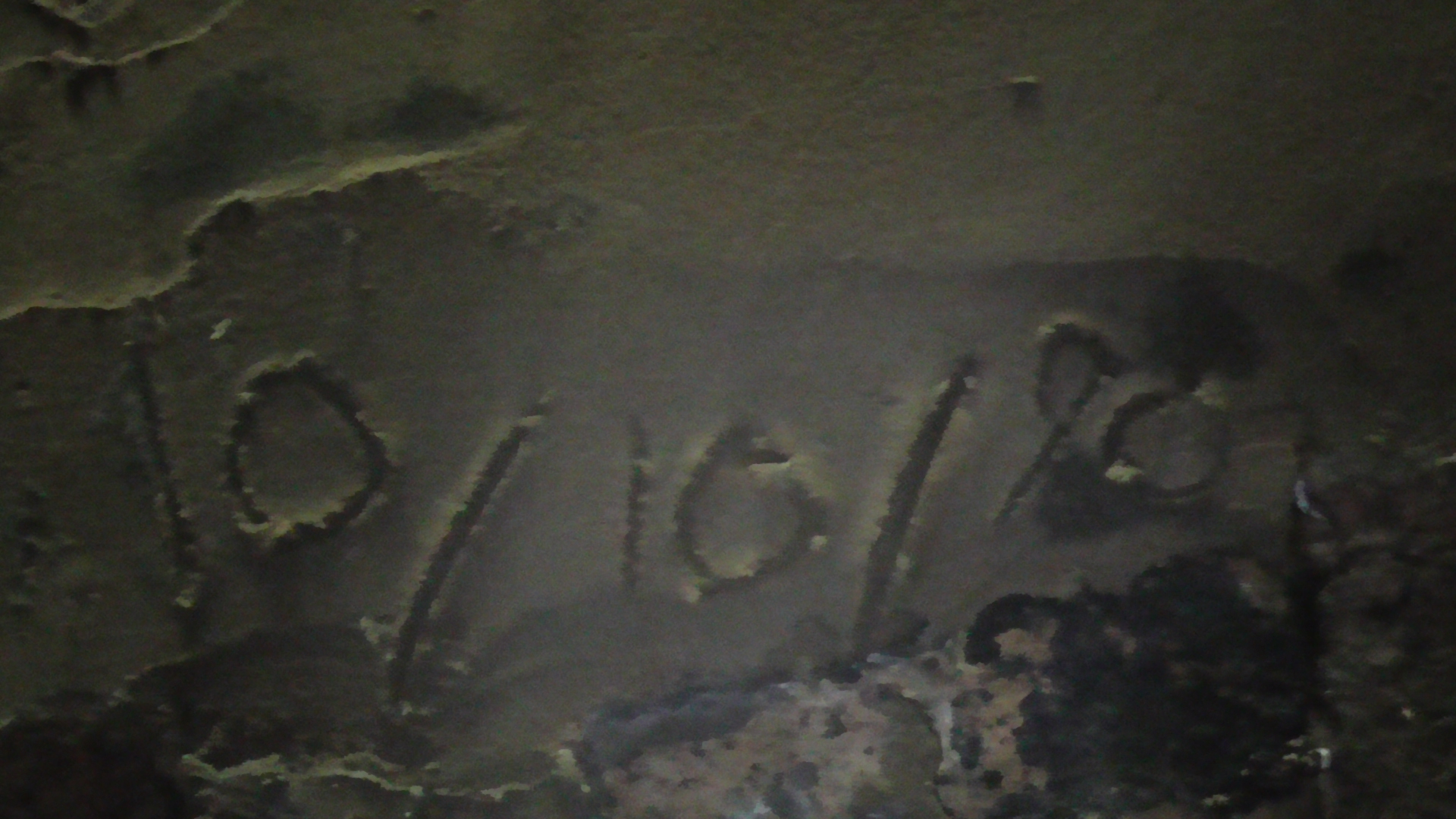
A date carved on the tunnel brickwork would appear to show remedial works took place in October 1990. We know this was also around the time when the public sewer was replaced along John’s Lane.
At present, this right of Way has overgrowth and flooding issues within the tunnel itself which we are trying to establish the cause of. It has made the tunnel near impossible to walk on the Sheepwash side and is obscured as almost lost.
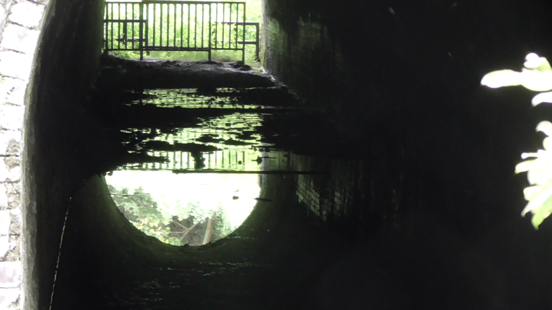
Standing in up to 1 Foot of water
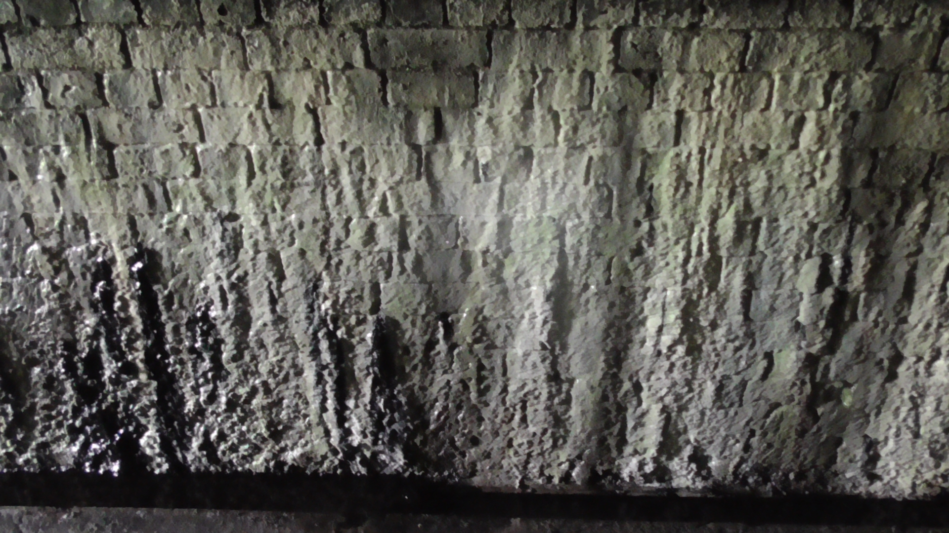
Water is pouring into the tunnel causing the build up of calcined waste on the wall.
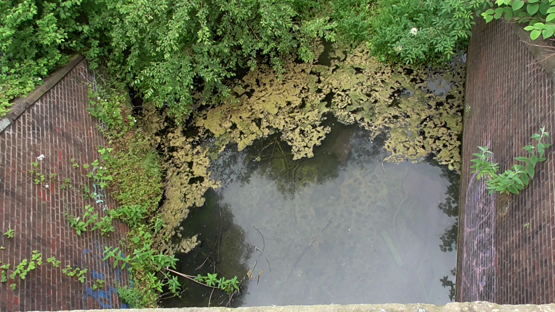
View from above the tunnel showing waterlogged path
MEMORIES AND FUTURE PLANS.
We asked people for their recollections of these tunnels and we invite their responses to be included on this page.
A complex land ownership of surrounding land make this a difficult issue to solve. The leak is either coming from the canal above- which would be the responsibility of The Canal And Rivers Trust. They at present appear to deny it is coming from this source. The Autobase estate to the rear of John’s Lane has a known history of leakage from out of the bank following a very poor job done on that embankment in the early 2000’s. The owner of that site needs to be approached by the council and also by Severn Trent Water.
This water company have a manhole that is blocked as a result of the unsanctioned work that was done by contractors of whoever owned the Autobase estate in the early 2000’s. A map showing the route of the sewer network and the issues can be seen below. The former sewage works site now has homes built upon it being Callaghan and Wilson Drives.
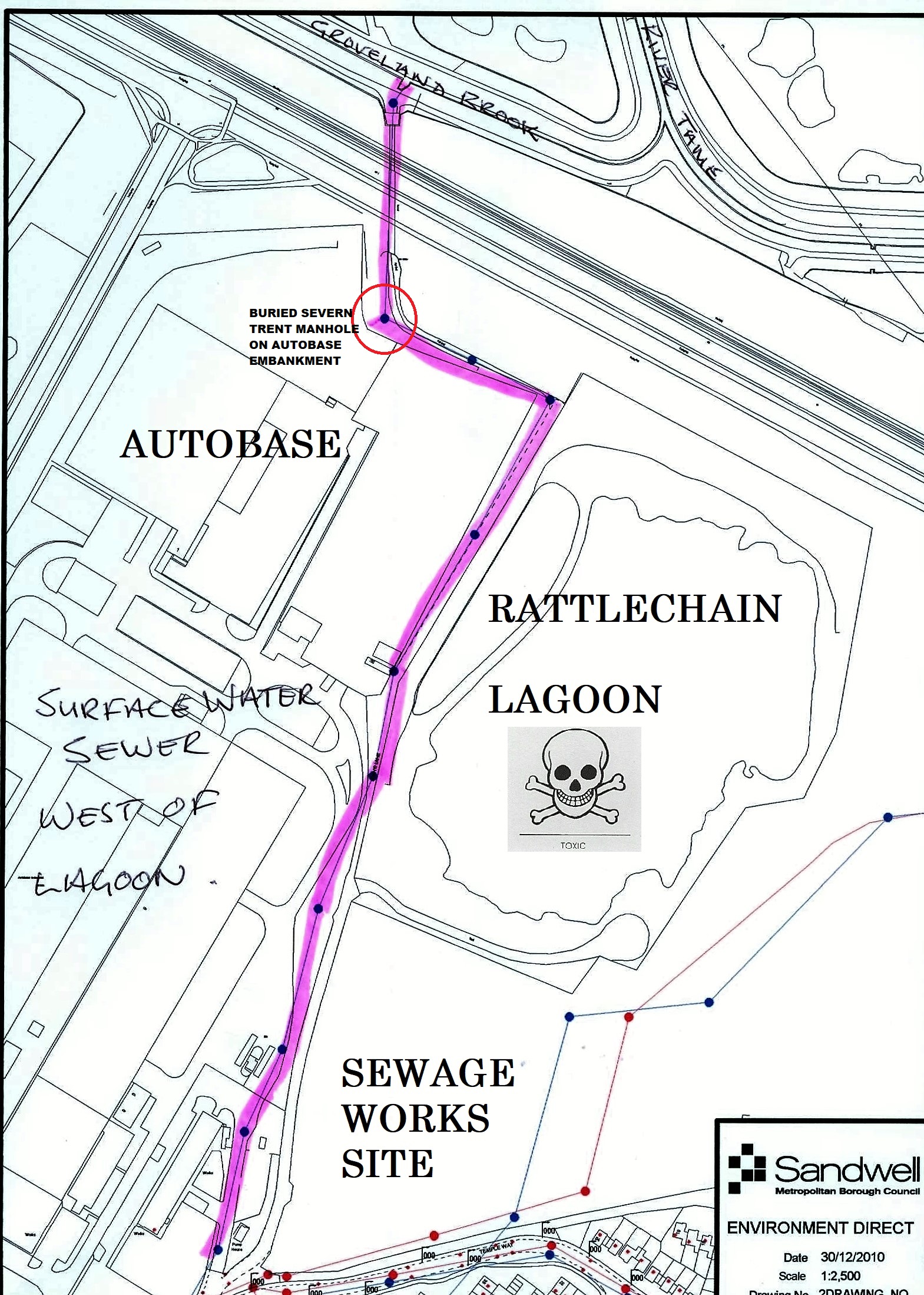
Unfortunately, Severn Trent have done absolutely nothing in the last 14 years that they have been made aware of their buried manhole and the issues they have failed to address. It is a disgrace that they continue in this regard , and once again the council need to act as do The Environment Agency who have control of the River course which ultimately the surface water sewer runs into.
Only when all of the named players get their act together can we expect this tunnel to be usable again as it has been for many generations.